Climate
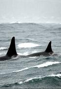
Ocean: The temperature of the Pacific Ocean to the west stays fairly constant year-around, about 55° F (13° C). The ocean acts as a vast heat-sink moderating temperatures in western Washington. Warm winters (40's and 50's F, 4-14° C) and cool summers (60's and 70's F, 18-25° C) are the norm on Fidalgo Island. Bringing rain, moderating temperatures and delivering storms, the ocean is the major influence on climate in the Pacific Northwest US.
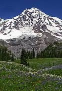
Mountains: Weather systems bring moist air from the Pacific into western Washington until it reaches the Cascade Mountains. A "Cascade Rain Shadow" barrier is created by the mountains. This keeps western Washington moist and eastern Washington more arid. Even during the summer, "ocean air" can produce cool, foggy early mornings here. See rainfall map.
Olympic Rain Shadow: Pilots call it the blue hole. Pacific weather systems usually move inland from southwest to northeast. The Olympic Mountain Range produces a second rain shadow. The southwest slope may receive 100-200 inches (2.5-5 m) of rainfall annually. The famous Olympic Rain Forest is the result. Off the northeast slope, Sequim and Port Townsend receive only 12-17 inches (30-43 cm) per year. Fidalgo Island, at the edge of the shadow, gets 20-26 inches (50-66 cm) yearly. During rainy weather, you might see the effect on the radar map. Compare Seattle which can expect 38 inches (97 cm) of rainfall annually. See rainfall map.
Pacific Storms: The winter jet stream often guides Pacific low pressure systems over Vancouver Island, Canada. These draw southerly winds up the Puget Sound Basin. Lying between the Olympics and Cascades, it becomes a wind tunnel. Fidalgo and Whidbey Islands bear the brunt of southerly wind storms when deep lows move in north of us. Wind speeds exceeding 30 mph (50 kph) are common during the fall and winter. We can also expect one or two storms yearly with winds exceeding 50 mph (80 kph).
Records and Averages Anacortes, Washington
| Month | Avg High | Avg Low | Rec High | Rec Low | Avg Precip | High Precip | Low Precip |
| January | 45° F | 35° F | 65° F (01/31/1935) | 6° F (01/08/1909) | 3.56 in | 8.14 in (1971) | 0.60 in (1985) |
| February | 49° F | 36° F | 69° F (02/3/1930) | 9° F (02/07/1936) | 2.48 in | 5.80 in (1982) | 0.42 in (1920) |
| March | 52° F | 38° F | 79° F (03/30/2004) | 18° F (03/02/1971) | 2.31 in | 5.22 in (1916) | 0.16 in (1911) |
| April | 58° F | 42° F | 83° F (04/15/1923) | 27° F (04/18/1909) | 1.83 in | 4.52 in (1896) | 0.25 in (1956) |
| May | 64° F | 46° F | 90° F (05/31/1922) | 31° F (05/12/1908) | 1.57 in | 4.52 in (1894) | 0.00 in (1924) |
| June | 68° F | 50° F | 95° F (06/25/1925) | 33° F (06/16/1922) | 1.37 in | 4.29 in (1917) | 0.04 in (1922) |
| July | 72° F | 52° F | 101° F (07/29/2009) | 35° F (07/03/1909) | 0.80 in | 3.18 in (1932) | 0.00 in (1896) |
| August | 72° F | 52° F | 95° F (08/10/1931) | 33° F (08/13/1913) | 1.00 in | 4.31 in (1990) | 0.00 in (1893) |
| September | 68° F | 49° F | 88° F (09/05/1944) | 19° F (09/01/1905) | 1.53 in | 3.55 in (1983) | 0.11 in (1991) |
| October | 59° F | 45° F | 82° F (10/01/1923) | 23° F (10/26/1906) | 2.64 in | 6.39 in (1945) | 0.11 in (1987) |
| November | 51° F | 39° F | 71° F (11/09/2016) | 10° F (11/23/1985) | 3.84 in | 10.67 in (1990) | 0.53 in (1943) |
| December | 46° F | 36° F | 74° F (12/30/2010) | 4° F (12/17/1964) | 3.79 in | 12.46 in (1917) | 0.59 in (1985) |
| Source: NOAA (wrcc.dri.edu) (Updated 03/25/2017) | |||||||
| Precipitation | Average Temperature | |
| Average Annual: | 26.73 in | 50.9° F |
| Highest: | 39.43 in (1990) | 53.6° F (1941) |
| Lowest: | 15.97 in (1952) | 48.5° F (1955) |
| Avg Annual Snowfall: | 5.1 in | |
| Highest Snowfall: | 25.7 in (1951) |
South Fidalgo Station Climatological Summaries
| 2006 | 2011 | 2016 |
| 2007 | 2012 | 2017 |
| 2008 | 2013 | 2018 |
| 2009 | 2014 | 2019 |
| 2010 | 2015 | 2020 |
Back to top


