The John Tursi Trail
A brand new hiking trail is now open on Fidalgo Island. The John Tursi Trail (.pdf) connects Campbell Lake with the Ginnett Hill summit in Deception Pass State Park. I hiked this trail last week, and I have to say, it was a real adventure. The new trail makes it possible to hike between Pass Lake in the park and Campbell Lake, about 2.5 miles/4 km altogether. For this first hike, I just walked the 1.1 mile stretch from Donnell Road to Ginnett and back.
Be aware and respectful that the Donnell Road trailhead is on private property. Find it at the end of the road, on the right, just before the obvious "Private Property" signs. Also, you may not park on Donnell Road. Use the paved parking strip at the intersection of Campbell Lake Road, Heart Lake Road and Sharpe Road. It will then be about a half mile walk to the trailhead.
 |
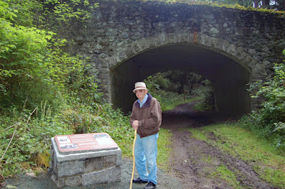
| John Tursi in 2010, Skagit Land Trust photo, by permission |
I find trails enticing. I am compelled to find out where they go and what I'll see along the way. I was amazed at the amount of work it took to create this trail. A lot of it had to be built up with rockeries that produced some beautiful landscaping in the woods. Yet very little impact, if any, can be seen beyond the edges. The trail was cut by volunteers from the Washington Trails Association and by the folks from SWITMO. Altogether, this was a team effort with partners from the Skagit Land Trust, Skagit County Parks and Recreation and Deception Pass State Park as well as WTA and SWITMO. Click or right-click the photos to view them full size.
In some places the terrain is quite rugged. This necessitated building retaining walls, steps and switchbacks to negotiate steep hillsides. Building this trail was not an easy task. When you hike it, pause to appreciate the labors of the volunteers who did the work here.
When you get to this fork in the road, go left over the log. Even though it is counterintuitive, you will be heading downhill. The right fork looks like the best route, but if you take it, you will get lost like I did. The right fork just disappears in the brush where you'll find yourself knee-deep in Salal. From the start of the hike you might cue in on the orange ribbons, probably used to guide the course of trail work. Standing in that Salal, I saw orange ribbons everywhere. They were no help. Just go left at the fork and the trail will be obvious the rest of the way.
UPDATE: 06/28/2016:
I was back on the John Tursi Trail today. Someone has come in and fixed this spot making it clear which way to go. Before, I wasn't 100% certain or I would have done something like this myself.
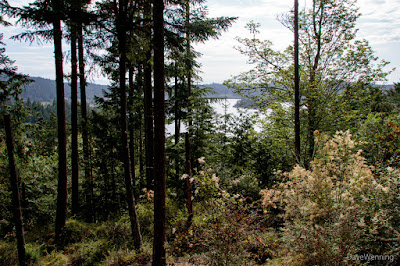
There are interesting sights and viewpoints along the way. Here, the trees thin out to offer a view of Campbell Lake.
Miner's Shack: If you download and print the trail map (.pdf) from the Skagit Land Trust site, you will also get descriptions of the historical sights along the way. Copper, manganese and rock wool were mined here in the 1910's and 1920's. Miners would have lived in this log cabin. I imagined them having to hike in and out through the woods with pack animals.
Copper Mine: The blue-green color gives it away. I had no desire to venture inside.
Morris Graves' Rock: Morris Graves was an artist of the Northwest School who lived on top of this bluff in the 1940's. The art style employed the symbolism, colors and lighting of the local area. The hill is now called Rodger Bluff. I have no idea who Rodger is.
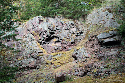
Red Rock Quarry: This quarry provided stone for Causland Memorial Park in Anacortes, known for its decorative rock structures. As with the copper mining, I wondered how they packed it out of here.
Trail's end is the Ginnett summit homestead site of Louis Hall and his wife. The site is edged by moss-covered balds and meadows with views into the valley. There was once a barn on the concrete slab. What's left of it is in a pile off to the side. Mrs. Hall's garden flowers, daffodils, Grape Hyacinth and Vinca continue to bloom around the edges. Just down the Ginnett Trail is a large fruit orchard. In the 1970's, the Halls sold the property in trust to Deception Pass State Park, but continued to live here until their deaths. This is one of my favorite spots in the park and now there are two ways to get here.
From this site, you can continue along the Ginnett Hill Trail all the way to Pass Lake, visible in the photo. You will discover one of the most beautiful trails in the park. Here in the midst of the rain shadow, it passes through a mossy, rain forest microclimate. Winter is the best time to experience it. On this hike, however, I didn't continue on that route. Instead, I returned to Donnell Road the same way I came in.
I would not call this an easy hike. There are some steep slopes that still have loose dirt, rocks and gravel to negotiate. Wear sturdy shoes or boots with good traction. The trail should settle and conditions improve with time. It took me an hour and 50 minutes to get to the top. I stopped a lot to look around, take pictures and get lost once. Plus, I'm old. It was only 40 minutes getting back down.
I have discovered something special about being one of the first to hike a brand new trail. It was a unique adventure. I can't wait to do it again.


